
At AtomGeo, we offer top-notch stereo photogrammetry data processing services to transform aerial imagery into accurate and detailed 3D models. Our team of experts, armed with the latest technology and extensive industry knowledge, is dedicated to delivering high-quality results tailored to your specific project requirements.
Our Services:
- Aerial Triangulation: Using precise aerial triangulation techniques, we ensure accurate alignment and orientation of aerial images, resulting in reliable and geospatially accurate 3D Our team meticulously analyzes image overlaps and tie points to optimize the aerial triangulation process.
- DTM (Digital Terrain Model) Generation: We specialize in generating high-resolution Digital Terrain Models (DTMs) from stereo aerial imagery. Our team leverages sophisticated algorithms and software to extract elevation information, allowing for precise terrain analysis and visualization.
- DSM (Digital Surface Model) Generation: With our DSM generation services, we create detailed Digital Surface Models from stereo imagery. DSMs capture above-ground features, including buildings, vegetation, and infrastructure, enabling comprehensive 3D visualization and analysis.
- Contour Generation: We extract accurate and detailed contour lines from stereo imagery, providing essential elevation information for engineering design, land development, and topographic mapping. Our team ensures the contours adhere to industry standards and project specifications.
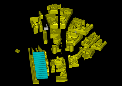
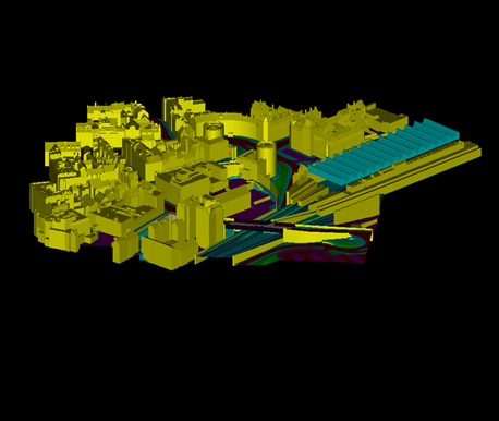
- 3D City Modelling: Our experts specialize in creating highly realistic 3D city models using stereo photogrammetry techniques. We accurately capture buildings, roads, vegetation, and other urban features, facilitating urban planning, visualization, and analysis.
- Planimetric Feature Extraction: AtomGeo excels in extracting planimetric features from stereo imagery, including roads, buildings, water bodies, and vegetation. Our team employs advanced algorithms and manual editing processes to ensure precise feature extraction.
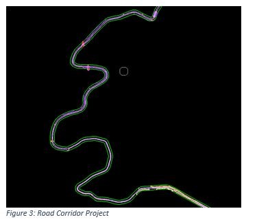
- Corridor Mapping: We offer corridor mapping services, accurately capturing linear features such as roads, railways, pipelines, and utility networks. Our team delivers detailed and geospatially accurate corridor maps for infrastructure planning and asset management.
- 3D Feature Extraction: With our 3D feature extraction services, we identify and extract various objects from stereo imagery, including buildings, trees, vehicles, and other point features. This information is crucial for applications such as urban planning, environmental monitoring, and asset inventory.
Our Team’s Capabilities:
At AtomGeo, our team of highly skilled professionals is proficient in stereo photogrammetry data processing. With extensive experience in utilizing advanced software tools and techniques, our experts ensure the utmost accuracy and efficiency in every project.
We understand the importance of collaboration and communication with our clients. Our team works closely with you to understand your project goals, requirements, and timelines, ensuring that the delivered products meet your expectations.
We are committed to delivering high-quality results within agreed-upon timelines and budgetary constraints. Our team’s expertise and dedication enable us to handle projects of varying complexities and sizes, delivering exceptional stereo photogrammetry data processing solutions.
Contact us today to discuss your stereo photogrammetry data processing needs and learn how AtomGeo can transform your aerial imagery into precise and valuable 3D models.

04

05
06
01

02
03