
AtomGeo is a leading provider of mobile mapping data processing services, offering accurate and reliable solutions for extracting valuable information from mobile LiDAR and imagery datasets. Our dedicated team of experts, equipped with cutting-edge technology and extensive industry knowledge, is committed to delivering high-quality results tailored to your specific project requirements.
Our Services:
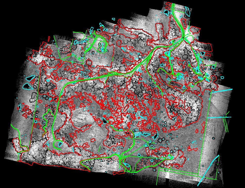
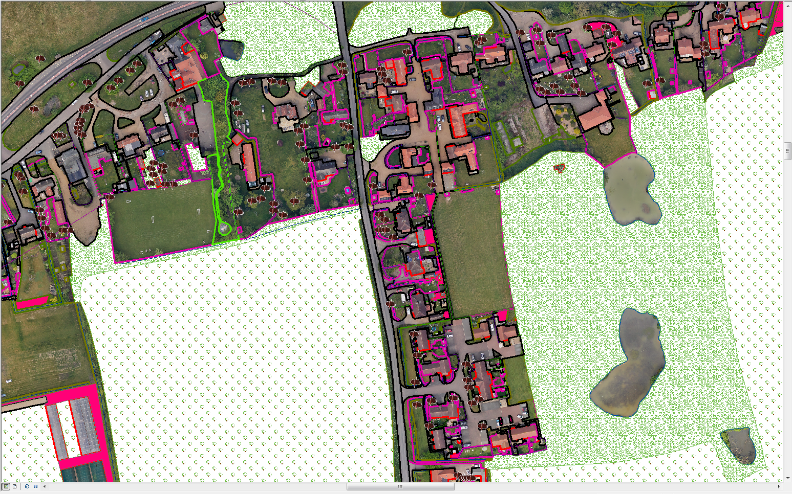
- 2D & 3D Feature Extraction: We specialize in extracting 2D and 3D features from mobile LiDAR and imagery datasets. Our team utilizes advanced algorithms and manual editing processes to identify and extract objects such as buildings, roads, trees, signs, and other point features with exceptional precision.
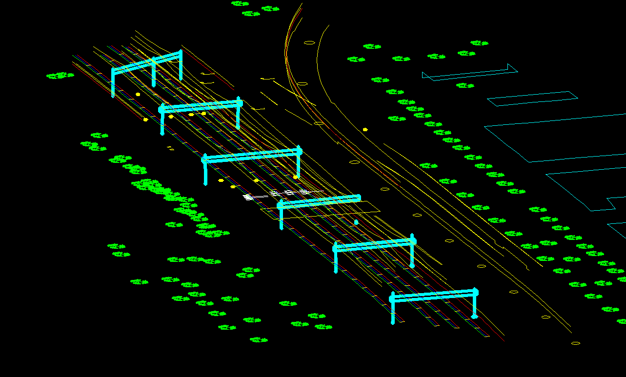
- Vectorization of Powerlines and Pipelines: AtomGeo excels in vectorizing powerlines, pipelines, and other linear features from mobile mapping data. We accurately trace and extract these features, providing geospatially accurate and up-to-date information for infrastructure planning and maintenance.
- Utility Mapping: Our utility mapping services involve capturing and mapping underground utility networks, including water, gas, and telecommunications infrastructure. We employ sophisticated data processing techniques to deliver accurate and reliable utility maps for asset management and maintenance.
- Asset Inventory and Management: With our mobile mapping data processing capabilities, we help clients create detailed inventories of assets such as street furniture, signage, and vegetation. Our team accurately maps and classifies these assets, providing essential information for maintenance, planning, and regulatory compliance.
- Terrain and Surface Modeling: We utilize mobile LiDAR and imagery data to create high resolution terrain and surface models. Our experts extract elevation information with exceptional accuracy, enabling precise terrain analysis, flood modeling, and urban planning.
- Change Detection and Monitoring: Our team performs change detection and monitoring analysis using mobile mapping data. By comparing multiple datasets over time, we identify and analyze changes in features, infrastructure, and the environment, supporting decision making and asset management processes.
- Data Fusion and Integration: We specialize in fusing mobile LiDAR, imagery, and other geospatial datasets for comprehensive analysis and visualization. Our team integrates various data sources to provide a holistic view of the environment, enabling informed decision-making and effective planning.
Our Team’s Capabilities:
At AtomGeo, we have a highly skilled team of professionals experienced in mobile mapping data processing. Our team members possess expertise in utilizing industry-leading software tools and techniques, ensuring the highest level of accuracy and efficiency in every project. We prioritize client collaboration and communication. Our team works closely with you to understand your project goals, specifications, and deadlines, ensuring that the delivered products meet your expectations.
With a proven track record of successfully completing projects of varying complexities and sizes, we are confident in our ability to deliver exceptional mobile mapping data processing solutions tailored to your specific needs.
Contact us today to discuss your mobile mapping data processing requirements and discover how AtomGeo can help you unlock the full potential of your mobile mapping datasets.
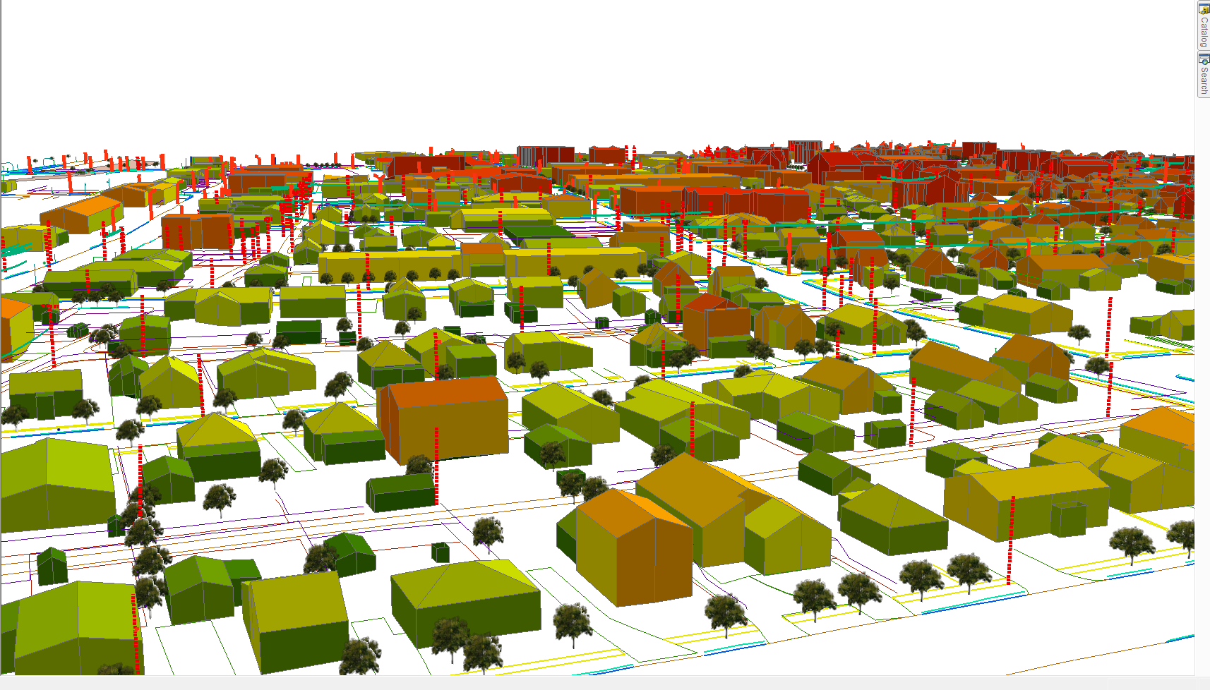
3D City Modelling

3D MAPPING
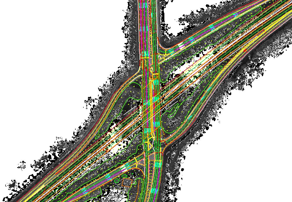
3D ROAD MAPPING
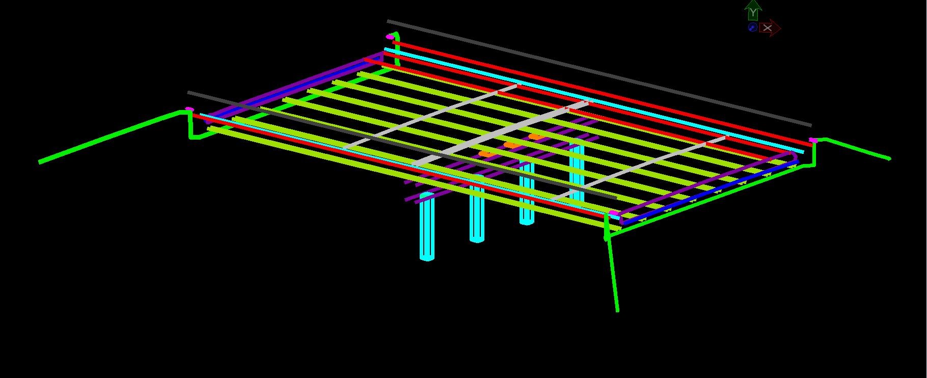
BRIDGE MODELLING

BRIDGE MODELLING_1

CARTOGRAPHIC MAPPING

DRONE MAPPING
DRONE MAPPING_1
Habitat Mapping
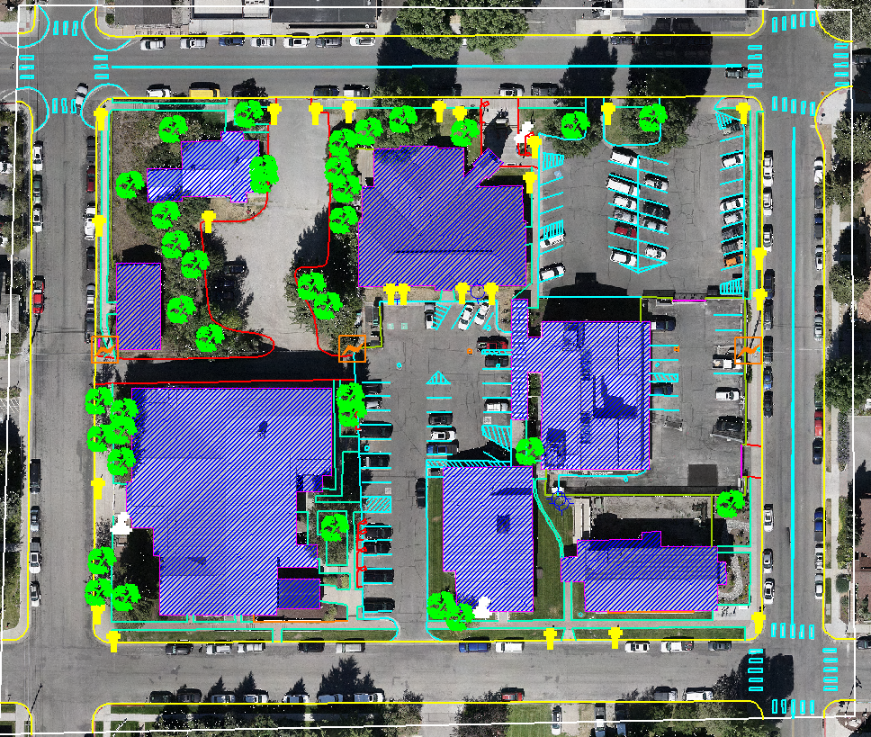
PLANIMETRIC MAPPING
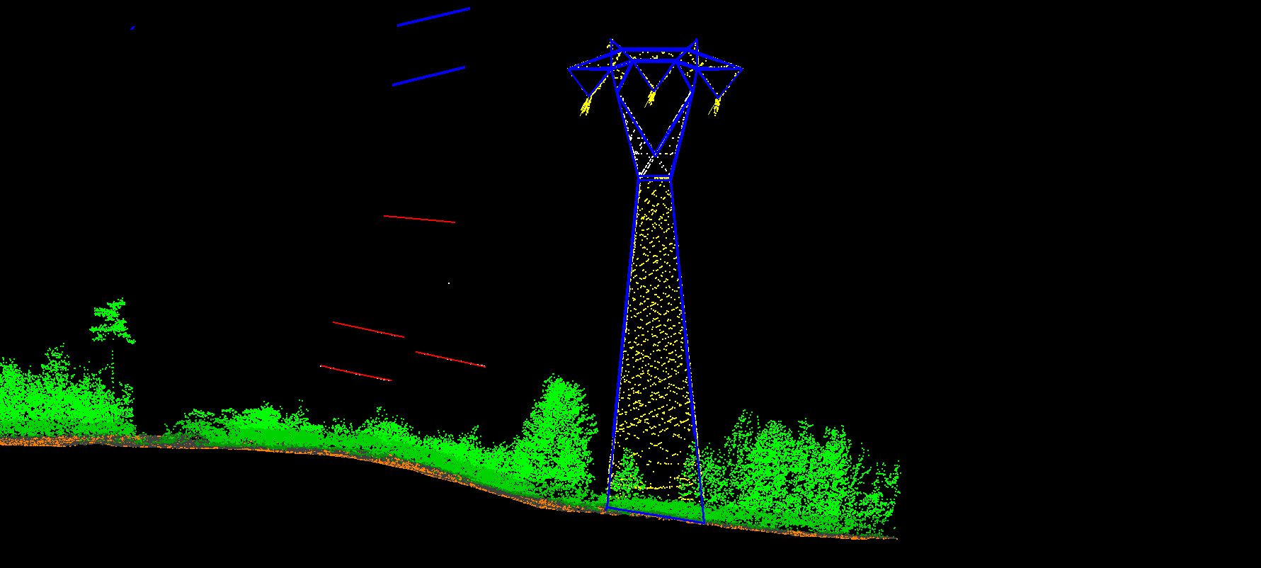
POWERLINE VECTORIZATION
RAILWAY MAPPING

TOPOGRAPHIC MAPPING
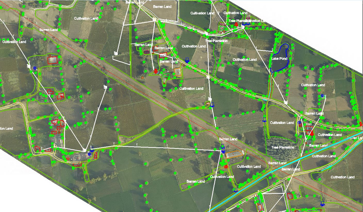
Topographical Mapping

3D BUILIDNG