


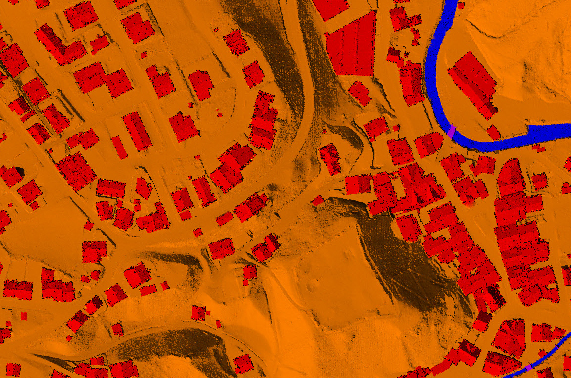
LiDAR (Light Detection And Ranging) , an innovative technology in the field of topographical data collection with high speed, high density and accurate data. We in Atom geo are committed to provide our clients with high quality output based on their requirement in less turnaround time.
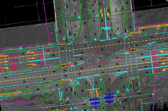
Atomgeo are equipped to provide services in digital photogrammetry to our global clients, with extensive experience and highly qualified, well trained and skilled resources along with the latest hardware/software; we are well equipped to provide the full range of services in digital photogrammetry like
Mobile Laser scanning, a innovative technology in the field of topographical data collection with high speed, high density and accurate data. We in Atomgeo are committed to provide our clients with high quality mapping work based on their requirement in less turnaround time.
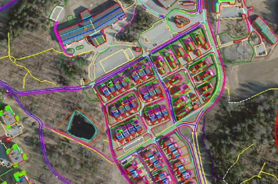
Atomgeo provides GIS Mapping & Data conversions Services to its clients across the globe.Our GIS services allow us to visualize geographic data, analysis of spatial relationships, and efficient data management. GIS data conversions allow data from diverse sources and utilize theinformation
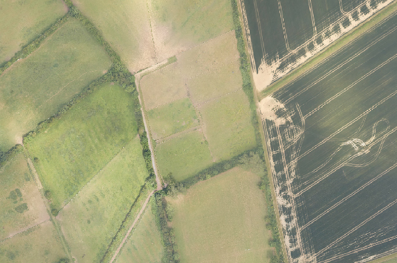
Atomgeo have expertise in generating digital Orthophoto that match the resolution of the aerial images with continuous tone,our team is well experienced in applying variety of image enhancement and edge sharpening procedures using advanced Image processing methods. Othophoto process encompasses matching color, contrast and feathering techniques to ensure a practically unified mosaic.
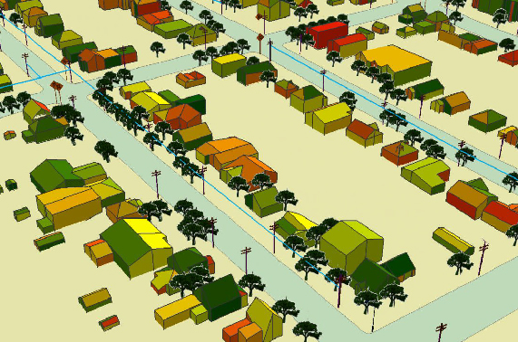
Atomgeo provide comprehensive point cloud to 3D model services, with wide-ranging experience of converting point cloud data for customers across the globe. Our experienced team comprises of engineering and CAD designers with expertise in 3D CAD modeling.

Projects Completed

Satisfied Clients

Drone Surveys